It is essential to have accurate bathymetry (below water) and topography (above water) data at the start of any nearshore field campaign. Therefore, I asked Shore Monitoring & Research to survey a 2-km stretch of coast in which we will carry out the AEOLEX-II campaign. This Wednesday Shore-staff used their jet-ski, quad and survey wheel to collect the data in the subtidal and intertidal zone. If all goes according to plan, Shore will deploy their UAV-LiDAR to measure the topography of the foredune next Saturday. This UAV-LiDAR is a first for us. I am extremely keen to see its performance, especially whether the LiDAR is capable of seeing the sand surface beneath the dense vegetation cover on and landward of the foredune. Later next week FGLab staff will deploy their mobile terrestrial laser scanner (4WD with a RIEGL VZ-400 attached to an inertial navigation system with RTK-GPS, INS-GPS) in the same area. This will make for an excellent inter-comparison of surveying techniques.
|
On Wednesday 13 September 2017 the Dutch coast experienced its first autumn storm of the year. Wind speeds reached up to 10 Beaufort along the Wadden coast, with gusts up to 120 km/h. This provided a perfect opportunity for some "wind-watching" before starting the actual campaign. Before heading for Egmond, we stopped by at the Kennemer Dunes near Bloemendaal aan Zee. Here, trenches have been created that extend through the foredunes to allow for sediment transport from the beach into the dunes. Despite the narrow beach in front of the dunes, the southwesterly-westerly winds moved spectacular amounts of sand through the trenches and into the hinterland. The foredune at Egmond aan Zee is more of a high, continuous ridge and sand transport into the dunes was not as obvious. As we walked along the beach from the town of Egmond to the AEOLEX-II field location, it was clear that small embryonic dunes had developed along large parts of the beach. These embryonic dunes are the first signs of new dune development and will continue to grow if left undisturbed by wave action. The 50 cm storm surge allowed the waves to reach the embryonic dunes at some locations alongshore, but not enough to make them disappear. We climbed onto the dune to make a time-exposure image of the surf zone. The areas of wave breaking provide an indication of the water depth and the presence of sandbars in front of the beach. Take a look at the movie below for a short impression of this stormy day. Hi everybody, welcome to our blog! In about a month from now, we will embark on a hopefully very windy field campaign to study aeolian (wind-blown) sand transport on the beach and the foredune at Egmond aan Zee, The Netherlands. We have called our campaign "AEOLEX-II", which is short for Aeolian Experiment and the II, yes, implies that we have performed an aeolian campaign here before (back in 2015). Our aim is to collect data on aeolian sand transport, surface moisture, ground water, wind, and morphology from the low-tide line to the crest of the foredune. During the first AEOLEX campaign we were surprised to see the enormous impact of the 25-m high foredune on aeolian transport dynamics on the beach. During AEOLEX-II we will therefore focus on this effect in particular. This time, the "we" are four students from the MSc programmes Earth Surface and Water (ESW) and Marine Sciences (MS), and four staff members from the coastal group in the Department of Physical Geography:
The campaign is embedded in Gerben's Vici project "Aeolus meets Poseidon", in which the aim is to develop a model to predict seasonal to annual input of wind-blown sand from the beach to the foredune. This first blog entry is finalized with a picture taking on Egmond beach in February 2017, when we measured aeolian process dynamics in about 15 m/s winds during storm Doris. 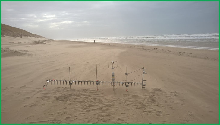 |
AuthorGerben Ruessink is Professor of Coastal Morphodynamics at Utrecht University Archives
November 2017
Categories |
 RSS Feed
