To understand wind-blown sand transport on a beach, it is necessary to study the wind processes (speed and direction) and of course how much sand is transported, but what people sometimes forget is that the hydrological processes are important as well. Especially on a beach! The higher the amount of soil moisture, the lower the amount of sand transport will be. To fully understand the soil moisture dynamics on a beach; groundwater fluctuations, the tide and meteorological processes are measured.
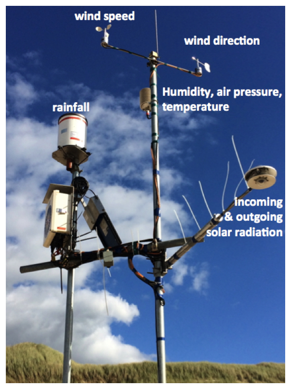
In March of this year we already did a pilot, but now it’s the real deal, so everything had to be perfect. Instead of 8 groundwater wells, we now have 10 groundwater wells. The pressure sensor to measure the tide is now sitting closer to the shore line, since in March we couldn’t reach it anymore. We have extra soil moisture sensors which are measuring in the vertical direction at 6 depths (10 cm, 20 cm, 30 cm, 40 cm, 60 cm and 100 cm). The weather station is still the same, which includes a temperature sensor, humidity sensor, radiation sensor, tipping bucket (to measure rainfall) and wind sensors (for wind speed and wind direction). With all these sensors I can study the influence of the tidal cycle on the groundwater movement, and the influence of the groundwater movement on the soil moisture content at the surface. Also the consequences of evaporation and rainfall to soil moisture can be studied. Imagine this, when the tide rises, the groundwater level will rise as well and will reach closer to the soil surface and thus soil moisture will rise too. Evaporation causes soil moisture to lower and of course rainfall does it the other way around. All of this is measured to understand how the Dutch dunes can grow with sea level rise.
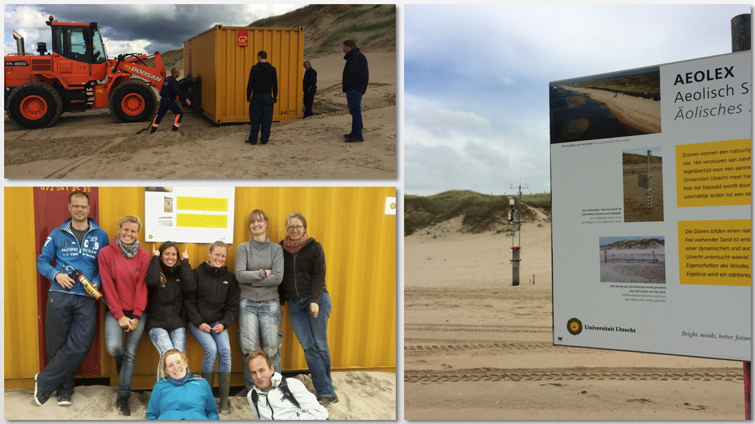
Our dunes can grow due to sand transport by wind. Wind speed and wind direction are important factors in this process. The width of the beach is of great importance as well. A wider beach increases sand transport but also remember: the higher the soil moisture content, the lower the amount of sand transport by wind processes will be. Soil moisture behaves like a glue that holds the sand grains together, which makes it harder for the wind to transport the sand. My colleagues (Winnie and Pam) are studying the beach width with pictures of the Argus Tower, the wind processes and how much sand is actually transported by it. I am studying the soil moisture content at the beach and in the end a model will come out of it, which hopefully will predict how much the dunes will grow over the coming ±10 years. Another colleague of mine, Jasper, will combine the results of Winnie, Pam and me and will put this model together. To make this expedition a bit more easier than the pilot in March we now got ourselves a big yellow sea container where we can store all of our devices. Fancy, isn’t it?! Our technicians did a great job by helping us building up the field site and arranging the sea container. Also new informations signs are located at our field site. So people can read what we are doing and won’t ask us all the time. Although, I like explaining it.. It makes life a bit easier and the wonderful weather is helping too! Until now I have a lot of groundwater data, since the groundwater sensors register the groundwater height each minute. Also the tide is measured every 1/10 seconds and the meteorological parameters are also measured each 5 minutes. Soil moisture is measured by hand, which in the beginning looks like fun, but after two weeks it’s probably one of the most boring jobs you can imagine. But when the results are satisfying, which until now they are, it will help you continue to do these boring measurements. The dataset is getting bigger every day.
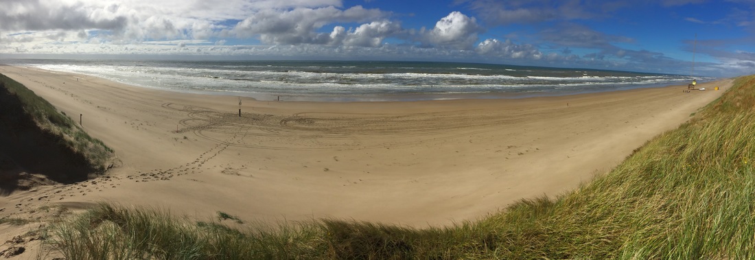
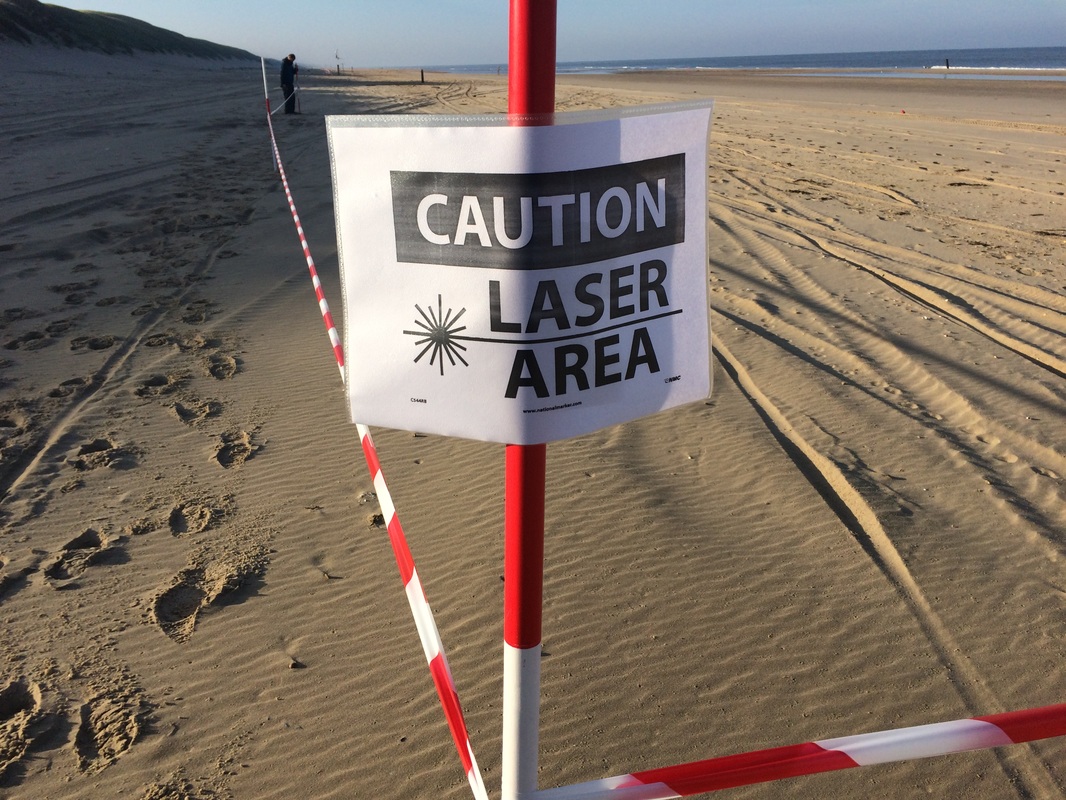
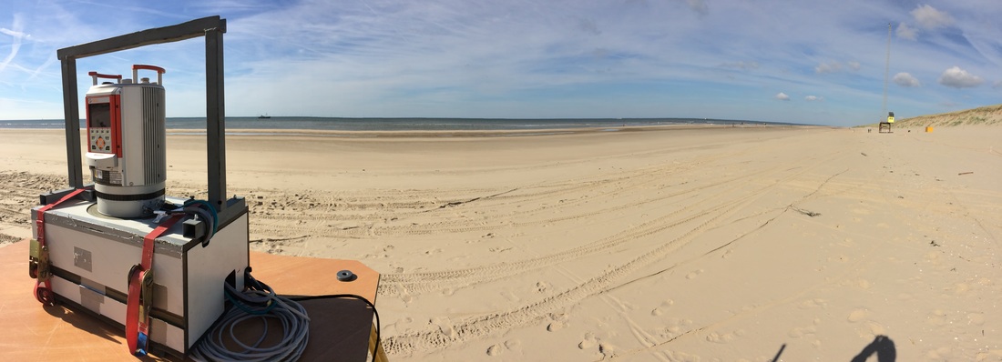
The weather is so good that we even did a complete day of laser scanning the beach. With the laser scanner I can measure soil moisture for a large area (approximately 80 meters by 80 meters). To do so we used barrier tape to delimit a large area of the beach. In combination with some signs that said: ‘Caution Laser Scanning’, we hoped people wouldn’t walk through our laser scanning area. You wouldn’t believe the things passers hurled at our heads. Some were very enthusiastic and interested in what we are doing. Others were angry that they had to walk 100 meters more. Some people didn’t want too much sand blown over the dunes, since their kitchen garden wouldn’t survive the amount of sand. There were people who said we’d better stop, because they are walking on the beach for years and know exactly how this sand transport by the wind works. Also soil moisture isn’t interesting to measure… just look at the beach: it’s wet! And I guess some people cannot read or do not know what a red barrier tape means.. or even worse: they just don’t care! I have to say, it really makes me sad that there are people who don’t see the importance of this research and who don’t care about anything else than their own kitchen garden. Well, I can tell you one thing; if we stop this research and sea level will rise, there will be no kitchen garden left! Ok, maybe that’s a bit exaggerated.. but still…
 RSS Feed
