
Blog entry by Floris Keizer - Junior Lecturer / Researcher
In our project, we look at sediment transport and deposition in a lowland river and on the adjacent floodplain, which means most of the work happens during and after flood events in winter and spring. On this, I have written several blog posts (Ecohydrology and MSc work in 2012; Ecosystem services of sedimentation; Unexpected early flooding in January and a second flood peak in April). However, what is the use of characterizing sediment and attached nutrient input is you have nothing to relate it too? During dry phases, the imported nutrients are made available for plant growth. This was the topic of my summer field campaign beginning of August and hence the rationale behind the title as now I completed the Four Seasons of Olszowa Droga, one of my sampling locations.
In our project, we look at sediment transport and deposition in a lowland river and on the adjacent floodplain, which means most of the work happens during and after flood events in winter and spring. On this, I have written several blog posts (Ecohydrology and MSc work in 2012; Ecosystem services of sedimentation; Unexpected early flooding in January and a second flood peak in April). However, what is the use of characterizing sediment and attached nutrient input is you have nothing to relate it too? During dry phases, the imported nutrients are made available for plant growth. This was the topic of my summer field campaign beginning of August and hence the rationale behind the title as now I completed the Four Seasons of Olszowa Droga, one of my sampling locations.
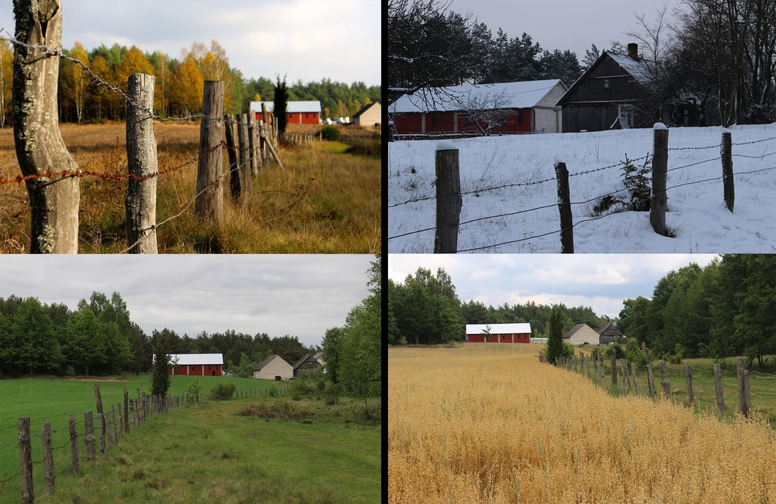
Autumn, winter, spring and summer in Olszowa Droga (Alder Road).
With vegetation productivity (measured as aboveground biomass of living vascular plants) and plant species recordings at every site where sediment transport and deposition was measured, we can now hopefully say something about the actual effect of sediment on vegetation productivity and plant species diversity.
Because I was not familiar with all the Carex and grass species, I teamed up with Aat Barendregt. The deal was he would assist me and I would assist him in his project. Aat has been here more than 20 years ago, so the first days were filled with 'this has really changed' and 'where are the cobble roads?' and 'this used to be [fill in yourself]'. It made me realize the more how fast Poland has been changing over the last decade, and even from campaign to campaign I can see the highway progressing and the modern iron fences being built in the hamlets.
The previous time, in 1993, Aat sampled interstitial (pore) water from the thick mud layer in oxbows (former river beds) and made a vegetation decription. These oxbows are numerous in the Biebrza floodplains and are thought of as important nutrient sinks and Aat wanted to repeat the measurements to see how nutrient content has changed over the course of 20 years and compare the oxbow vegetation. In the Biebrza floodplains, the oxbows can be found from the river until the edge of the floodplain.
The previous time, in 1993, Aat sampled interstitial (pore) water from the thick mud layer in oxbows (former river beds) and made a vegetation decription. These oxbows are numerous in the Biebrza floodplains and are thought of as important nutrient sinks and Aat wanted to repeat the measurements to see how nutrient content has changed over the course of 20 years and compare the oxbow vegetation. In the Biebrza floodplains, the oxbows can be found from the river until the edge of the floodplain.
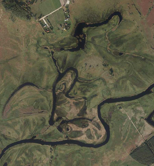
The studied oxbow complex.
As a hydrologist, I could image what an oxbow would look like when your paddling in it with your cayak: something like an old river course, but with standing water and probably more vegetation. It also seemed logical to me that sediment would accumulate there during floods because of reduced flow velocity. Oxbows act as a sink. What I did not expect is that you are actually paddling through a layer of mud as thick as one meter, with in some cases just 10 cm of surface water! This was creation of land at work! Most striking was the difference in aquatic vegetation when we went from river-influenced to the far ends of the oxbows. Although the entire system was hydrologically connected, we could still speak of lentic and lotic environments in my opinion with very different water quality (nutrient-rich river water vs. buffered and relatively nutrient-poor groundwater seepage). The characteristic Stratiotes aloides (Water soldier) was only found at the far ends of the oxbow were water was shallow and standing. High-productive species of reed and Typha latifolia (Cattail) were more dominant in the river-influenced zone and mostly absent at the far ends.
Paddling through the oxbow and gaining insight in the role of oxbows for sedimentation, we collected another piece of the puzzle of sediment and nutrient transfer in lowland floodplains. It was a fruitful campaign on the water-land transition zone.
 RSS Feed
